
Description
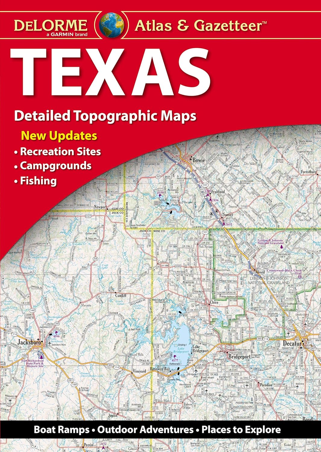
Book Synopsis: With an incredible wealth of detail, DeLorme's Atlas & Gazetteer is the perfect companion for exploring the outdoors in Texas.
Details
Explore the great outdoors of Texas like never before with DeLorme's Atlas & Gazetteer. Packed with an incredible wealth of detail, this book is the ultimate companion for every adventurer. Whether you're planning a scenic drive, hiking trip, or fishing excursion, our full-color topographic maps will provide you with all the information you need. From cities and towns to historic sites and prime fishing spots, no detail is overlooked. With convenient dimensions of 15.5" x 11", you can easily carry this comprehensive guide with you wherever you go.
Don't waste time searching for information online. The Atlas & Gazetteer is extensively indexed, making it easy to find exactly what you're looking for. Plus, our handy latitude/longitude overlay grid for each map allows you to navigate with GPS, ensuring you never lose your way. Inset maps are provided for 100 major cities as well as all state lands, so you can easily find your bearings in even the busiest areas. With DeLorme's Atlas & Gazetteer, you'll have the power to explore Texas like a pro.
Don't miss out on this essential tool for outdoor enthusiasts. Order your DeLorme Atlas & Gazetteer today and embark on your next adventure with confidence. Visit our website and check out our full selection of Atlas & Gazetteer books available for all 50 states. Get ready to discover the hidden gems of Texas and create memories that will last a lifetime. Order now and start exploring!
Discover More Best Sellers in Reference
Shop Reference
Rand McNally Easy To Read Folded Map: Tennessee State Map
 Reference - Rand McNally Easy To Read Folded Map: Tennessee State Map

Rand McNally Easy To Fold: Southern California Laminated Map
Reference - Rand McNally Easy To Fold: Southern California Laminated Map

Rand McNally Easy To Fold: Washington State Laminated Map
Reference - Rand McNally Easy To Fold: Washington State Laminated Map

Rand McNally Easy to Read: Pennsylvania State Map
Reference - Rand McNally Easy to Read: Pennsylvania State Map

English for Everyone Course Book Level 2 Beginner: A Complete Self-Study Program
Reference - English for Everyone Course Book Level 2 Beginner: A Complete Self-Study Program

1,000 Places to See Before You Die: Revised Second Edition
Reference - 1,000 Places to See Before You Die: Revised Second Edition

Merriam-Webster’s Student Atlas - Features Full-Color Physical, Political, & Thematic Maps
Reference - Merriam-Webster’s Student Atlas - Features Full-Color Physical, Political, & Thematic Maps
 Reference - National Geographic Concise Atlas of the World, 5th edition: Authoritative and complete, with more than 200 maps and illustrations


